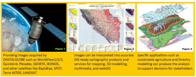
SEAMEO BIOTROP’s GIS and Remote Sensing Laboratory is a leading and advanced department in geospatial solution that helps decision makers and researchers to better understand the changing of our tropical biology and environment in order to save life, resources and time through geospatial information. This service is part of SEAMEO BIOTROP’s mission to provide scientific knowledge and capacity building in conserving and managing tropical biology sustainability for the well-being of communities and environment of Southeast Asia.
Food and feed safety and security
The stable supply of food is an important issue that ties in with daily life. In remote sensing, it is possible to investigate the changes in brightness accompanying the growth of paddy. This enables the estimations of rice acreage, and these statistics, in turn can be used to forecast the volume of the harvest. Information pertaining to forecasts on the volume of paddy can play a useful role in various food policies, such as in the prediction of supply and demand of food in the future. BIOTROP had in fact estimated location of the paddy plantation in provinces in Java, Indonesia.
Water resource management
The characteristics of rainfall are changing as a consequence of climate changes that have arisen as result of global warming. It is important to investigate the impact of these changes on water resources. By carrying out rainfall observation using satellites, there are expectations to obtain information on rainfall system around the globe. BIOTROP can produce information on rainfall distribution for the world using multiple satellites, including the Tropical Rainfall Measuring Mission satellite (TRMM). BIOTROP is taking steps to promote research in areas such as flood forecasting. BIOTROP provides support for the creation and analysis of rainfall distribution data sets.
Landscape Restoration and ecosystem health monitoring
Landscape restoration and ecosystem health monitoring is an important theme in the sustainable development of the Earth. It is possible to determine the condition of environment through the color composite display of satellite images taken over multiple time periods. This is useful in the conservation of forest, reclamation of mining and the prevention of illegal logging.
Management of tropical ecosystem function and maps
Satellite data, in particular high-resolution images, are utilized in the management of various facilities, such as forest, agriculture area and aquatic ecosystem. For instance, installation-related facilities use high-resolution images of Quickbird satellite to check the condition of structures in substation facilities, as well as the condition of transmission lines. These data thus play useful role in visual verification and management.
Disaster prevention, and maps
With the aim to mend the aftermath of the Tsunami Aceh, Indonesia, BIOTROP collaborated with other institutions drew up satellite image maps of Aceh and Sumatera coastal regions in PDF format. These maps contain coordinates (latitude and longitude) information on roads and public facilities, on satellites images. These maps are expected to be useful for areas affected by the disaster and to be utilized as information sharing among the concerned parties.
For more information, please contact Mr. Harry Imantho (harry@biotrop.org)

